The New Port
The port of Liverpool evolved out of a small fishing town during the late 17th century. Originally, the boats could beach onto the river front or moor in the small tidal creek estuary, below a castle.
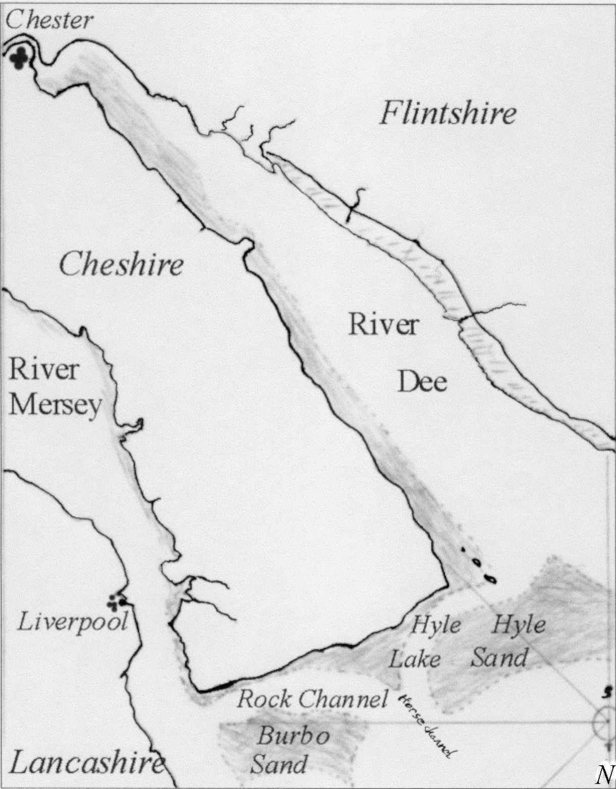
Chester had been deteriorating as a port for
many years and along the Cheshire coast of the broad Dee estuary (also known as
'Chester Water') there were several small quays and anchorages. Chester
port's golden age was probably well finished by 1200. The estuary below
Chester is wide and filled with sandbanks. Its tides rise and fall
relatively gently and the currents are not so severe as to drag vessels off their anchorages.
But in the Mersey estuary there is a dangerously swift tidal flow where the river narrows as it passes Liverpool. Because of this, the new port needed some kind of safe anchorage for cargo working. For many years the Hoyle (or Hyle) Lake, about ten miles from Liverpool, had been used to load and land ships' cargoes. It was a sea lake that was deep and big enough safely to contain many ships at anchor, even at low water. This made an ideal add-on to the early port of Liverpool. Flat-bottomed lighters were used to deliver and collect cargo to and from the ships anchored in Hoyle Lake.
During the 18th century the port began to grow and prosper. In 1715 the creek was reclaimed and Liverpool's first wet dock was built. Shipping and shipwrecks, on the sandbanks of Liverpool Bay, increased rapidly. By 1760 the merchants of Liverpool decided that lighthouses would help to make the approaches to the port safer. The system of four lighthouses they built was designed to lead ships through the sandbanks and safely into the Hoyle Lake.
The chart shows the Wirral peninsula with the Mersey and Dee estuaries and the Hyle Lake
![]()
![]()
![]()